| |
 |
| Sokkia's Spectrum Survey Office (SSO) is an advanced, easy to use, powerful post processing program. SSO provides a full feature environment for processing and adjusting field observations created with the family of SOKKIA instruments. |
| |
| Features include: |
 |
Supports most SOKKIA GPS / GNSS, Total Station (TS) and Digital Level (DL) instrument and data collectors |
|
Compatible with Windows XP, Windows Vista and Windows 7 |
|
Various coordinate system and extensive Geoid model support |
|
Powerful adjustment features and reporting |
|
Multiple views of your job |
|
Modular |
|
| Spectrum Survey Office supports many data formats including: |
|
PDC files (GSR2700 ISX, GSR2700 IS, GSR1700 CSX, GSR2600, GSR2650LB, Radian, Radian IS) |
|
STR files (Stratus) |
|
JPS, TPS files (GRX1) |
|
| Spectrum Survey Office supports many data formats including: |
|
PDC files (GSR2700 ISX, GSR2700 IS, GSR1700 CSX, GSR2600, GSR2650LB, Radian, Radian IS) |
|
STR files (Stratus) |
|
JPS, TPS files (GRX1) |
|
| |
| Modules : |
RTK Module
RTK Module includes functionality for importing, displaying, adjusting, exporting, and reporting RTk data (data collected with RTK surveying using SS or other data collection software)
TS Module
TS Module includes functionality for importing, displaying, adjusting, exporting, and reporting data collected with total stations.
PP Module
Post Processing Module includes the engine for post processing and adjusting GPS+ data.
PP+ Advanced Module
Advanced Module includes additional options for processing, adjustment and localization |
| |
| |
| |
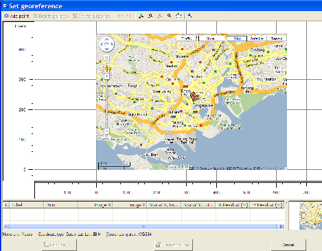
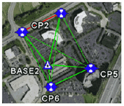
Supporting Google Earth
| SSO allows one to display a network on Google Earth satellite imagery |
|
|
| |
Adjustments
|
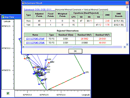
Least Squares free or constrained adjustment of separate or mixed GPS, TS andl DL Observations |
|
Separate adjustments for plane coordinates and for heights performed after network analysis by the Adjustment module |
|
Reports on adjusted points, fixed / weighted points, used and rejected observations, errors of unit weight (UWE) and UWE bounds |
|
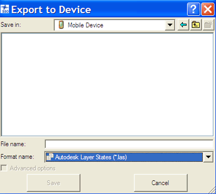
Export results to industry standard formats |
|
|
| |
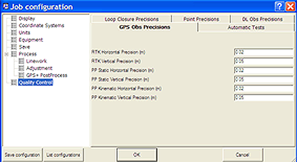
Quality Control
|
This option allows one set : |
|
Horizontal and Vertical precisions for static / kinematic / localization points |
|
Precision for a distance and horizontal / vertical angle of TS Observations |
|
Horizontal and Vertical precisions for RTK vectors and static / kinematic GPS post processed vectors |
|
Precision for digital level measurements |
|
The user can run the following tests : Warn Float Solutions, PP Static / PP Kinematic precisions, Point Standard Deviations, Identical Points test, Misnamed GPS Occupations / Autopo Rovers, Invalid Antenna Parameters |
|
|
| |
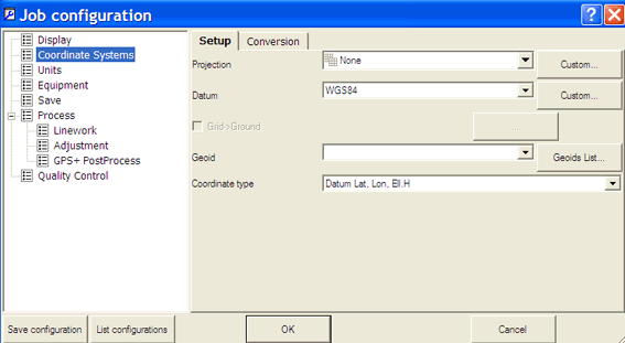
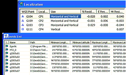
Localization and Coordinate Systems
|
Separate Horizontal and Vertical localization |
|
Localization Algorithm computing conversion parameters from WGS84 to a local system using one or more pairs of Control Points |
|
Extensive projections support including creation of custom projections / datums |
|
Wide range Geoid support |
|
|
| |
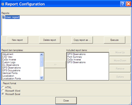
Report
| SSO allows one to generate a standard report for Points, Adjustment, Localization, Quality Control, GPS Observations and TS Observations, and create a custom report format |
|
|
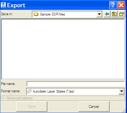
Export Data to File
| Exporting either desired data or all data of the current job file to a corresponding file format : Coordinates, Design, GIS, Road, SSO, XML, GPS Obs |
|
|
| |
|
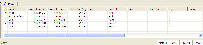
Tabular View
| The Tabular View contains tabs with tables of information on the points, occupations, observations, in the job |
|
|
| |
| |
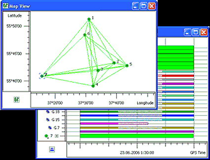
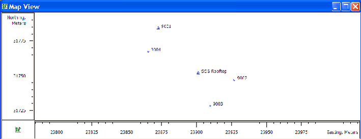
Map View
| The Map View is a graphical latitude / longitude or northing / easting plot of points, GPS / TS Observations and background map |
|
|
| |
| |
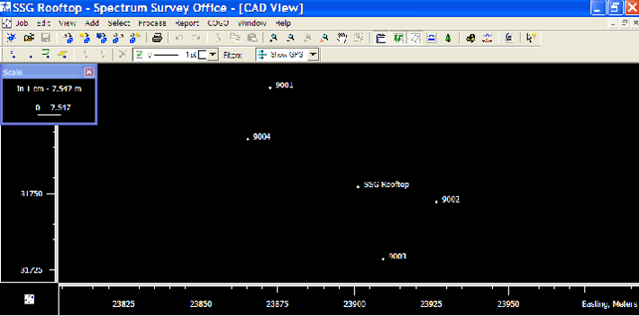
CAD View
| The CAD View is a graphical view of linework, roads, and surfaces with the associated points observations and background map |
|
|
| |
|
|
|
|
|
|
|
| |
|